
With Clocktogo, explore the charm of Virginia’s finest road trip destinations. Allow us to guide you along beautiful paths through undiscovered sights. Virginia is situated halfway between the Atlantic Ocean and the Appalachian Mountains, in the Mid-Atlantic and Southeastern parts of the United States. Therefore, the state of Virginia, formerly known as the Commonwealth of Virginia. Richmond is the state’s capital, Virginia Beach is its most populous city, and Fairfax County is its political unit. In 2022, Virginia had a population of about 8.68 million people, with 35% residing in the Greater Washington metropolitan area. The Blue Ridge Mountains traverse the state’s western and southern regions, while the Piedmont comprises most of its middle region. The Middle Peninsula, part of the Atlantic Plain, forms the mouth of the Chesapeake Bay. Explore Eastern Virginia! This region boasts beaches, waterways, and rich history.
Top 12 Road Trip Destinations In Virginia
Virginia offers many exceptional possibilities to enjoy a road trip or a beautiful driving tour. It is a patchwork of scenic natural beauty and several cultural and historical monuments. There are various thematic heritage and history trails to explore with a day trip, weekend break, or entire vacation road trip plan, in addition to the five official National Scenic Byways. Regarding fusing stunning landscapes with early American history, Virginia stands head and shoulders above most other states in the U.S.
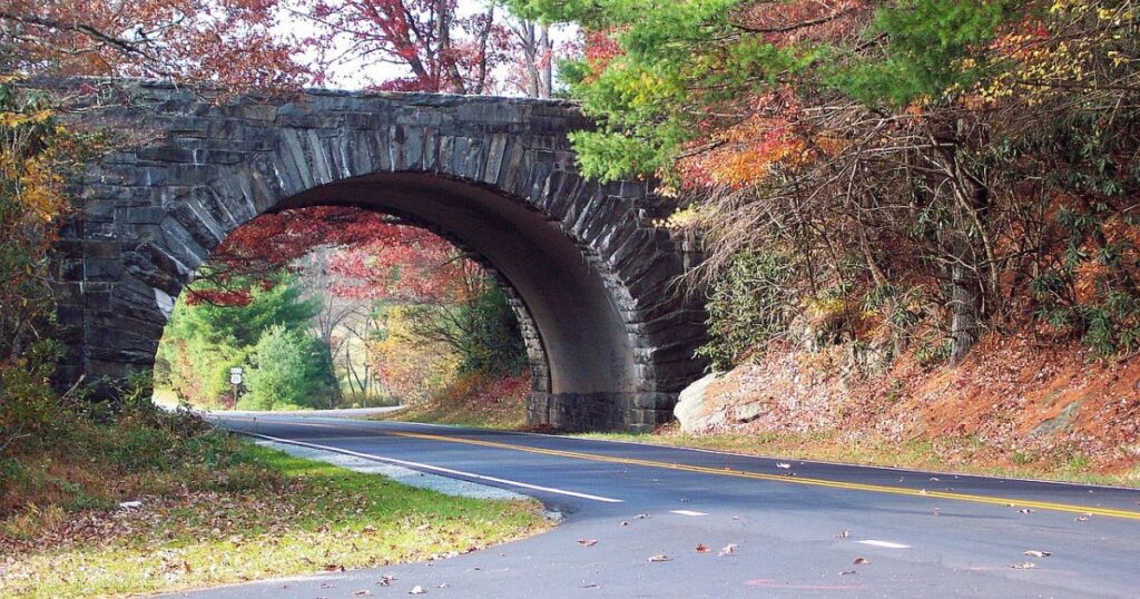
The Blue Ridge Parkway
The scenic Blue Ridge Parkway is a designated “All-American Road,” the highest distinction given by the Department of Transportation, meaning the road is distinct in the nation and a tourist destination. It was built as a recreational motor road connecting Shenandoah National Park and Great Smoky Mountains National Park. Most visited parkway! The Blue Ridge Parkway reigns supreme in the National Park System, welcoming the most visitors each year. Epic mountain drive. Stretching 469 miles, it winds across Virginia and North Carolina’s stunning Appalachian peaks.
The 217-mile Blue Ridge Parkway runs through the George Washington and Jefferson national forests for an extensive length in Virginia. A restored mountain farm close to Humpback Rocks, the James River, Peaks of Otter, Rocky Knob Mabry Mill (the most photographed Blue Ridge Parkway location), and the Blue Ridge Music Centre are popular stops in Virginia.
Skyline Drive
Skyline Drive, the sole public road through Shenandoah National Park, travels 105 miles in a north-south direction along the crest of the Blue Ridge Mountains. One of the country’s most picturesque highways is Skyline Drive, with 75 overlooks with stunning views of the Virginia Piedmont to the east or the Shenandoah Valley to the west.
In good driving conditions, driving the entire length of Skyline Drive, which has a 35 mph speed restriction, will take around three hours. Although Shenandoah National Park is accessible throughout the year, there are instances when certain sections of Skyline Drive may need to be closed due to bad weather. Shenandoah National Park has four entrances: Front Royal, close to Routes 66 and 340; Thornton Gap; Swift Run Gap; and Rockfish Gap, close to Routes 64 and 250. The Blue Ridge Parkway’s northern entrance is located in Rockfish Gap.
The Colonial Parkway
A horse-drawn carriage that regularly travels through Colonial Williamsburg’s streets.
WMay/Getty Pictures. The Colonial Parkway, which connects the historic sites of Jamestown, Colonial Williamsburg, and Yorktown, collectively known as America’s Historic Triangle, spans 174 years of colonial history despite being only 23 miles long. The Parkway is a component of Colonial National Historical Park, a complex National Park Service division.
The Colonial Parkway has a 45 mph speed limit, so it takes roughly 50 minutes to travel the entire distance. Still, most visitors will want to spend a day or more exploring the fascinating archaeological sites, living history attractions, monuments, and battlefields this charming historic area offers. Guided tours, biking and hiking trails, nature viewing, dining, shopping, and more are additional popular activities.
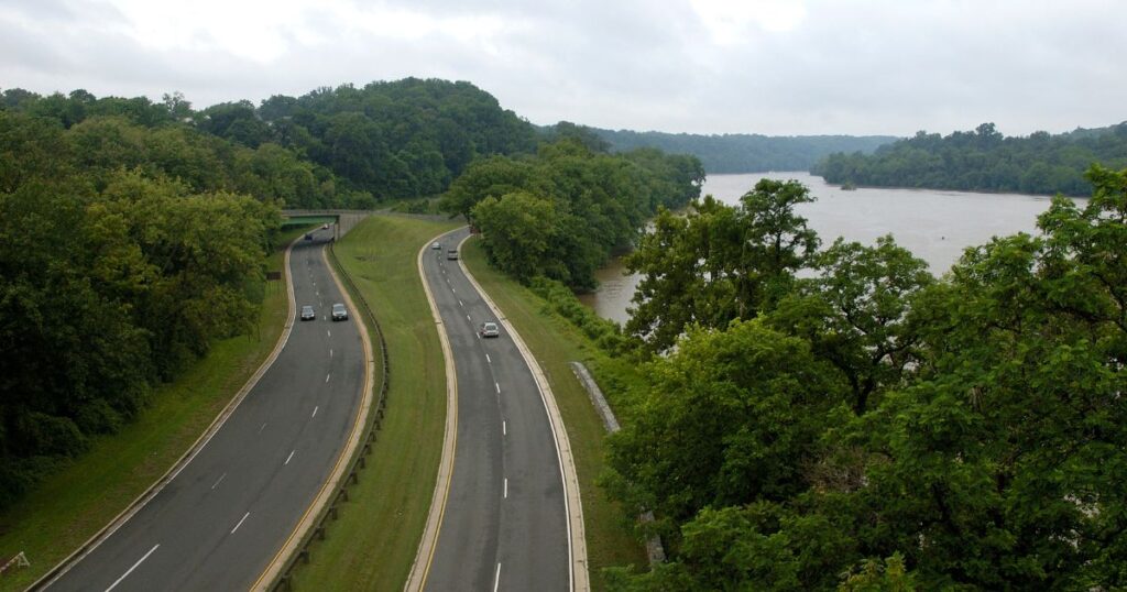
George Washington Memorial Parkway
This location is The George Washington Memorial Parkway, which runs mainly through Northern Virginia and follows the scenic Potomac River from Mount Vernon at its southern terminus north to Great Falls, Virginia. The route directly passes past Washington, D.C., which was thoughtfully planned and constructed as a majestic entrance to the city. Several historically significant locations, including many of the nation’s most recognizable monuments and memorials, are connected by this beautifully planted parkway.
The Mount Vernon Estate and Gardens, Old Town Alexandria, The National Mall in Washington, D.C., Arlington National Cemetery and Arlington House, and the U.S. Marine Corps War Memorial are just a few attractions to discover and take in along the George Washington Memorial Parkway. Several beautiful parks, hiking, bicycling routes, and wildlife preserves exist. The parkway is only 25 miles long, but there are so many places to stop that you could easily spend a few days or even longer if your itinerary includes Washington, D.C.
The George Washington Memorial Parkway is a significant commuting route into and out of Washington, D.C., so keep that in mind. Planning your road trip schedule should consider that weekday rush hour traffic is quite congested. The worst of rush hour typically lasts from approximately 6 a.m. to 10 a.m. and from about 3 p.m. to 7 p.m.
Journey Through Hallowed Ground National Scenic Byway
The 2009 designation of the Journey Through Hallowed Ground as a National Scenic Byway In a region referred to as the Journey Across Hallowed Ground National Heritage Area, the National Scenic Byway travels 180 miles across Virginia, Maryland, and Pennsylvania. Anyone interested in American history must take this route because the region is renowned for its historic sites. You will pass past significant places on the Underground Railway, nine presidential houses, over 50 historic villages, and battles from the Revolutionary, French-Indian, 1812, and Civil wars, among other conflicts.
The path begins at Thomas Jefferson’s Monticello in Charleston, Virginia, and travels north to Gettysburg, Pennsylvania. It takes around three and a half hours to travel the entire distance without accounting for stops along the way. Before leaving, list the places you must see because stopping at each would take weeks.
The Crooked Road Music Heritage Trail
The Crooked Road is Virginia’s Music Heritage Trail, where you may celebrate and protect the legacy of authentic mountain music. Explore the origins and traditions of old-time mountain music as you meander along the meandering roads through ten counties in the Appalachian area of southwestern Virginia. Experience the distinctive culture and heritage of the room while listening to country music jam sessions on the porches of neighborhood stores and eateries and exploring the fiddle and luthier shops.
This is a convenient and unusual Blue Ridge Parkway side trip as several places for a quick Crooked Road sampling are close to the Blue Ridge Parkway. Alternatively, arrange a thorough excursion to see numerous locations along the roughly 300-mile trail throughout a weekend or extended road trip. It starts in Franklin County and travels across South-west Virginia along the southern border before returning to Dickenson County.
Virginia Wine Trails
Home to six American Viticultural Areas (or AVAs) and over 200 wineries, Virginia’s many wine trails offer various options for a memorable driving tour. Wine trails are located in every region of the Commonwealth, from the Eastern Shore to the Western mountains, near charming towns, historic sites and attractions, and scenic vistas. You just have to choose which area stands out most to you.
Although wine trails can be explored throughout the year, October, designated as Virginia Wine Month, is one of the ideal months to organize a road trip through the state’s wineries. Numerous distinctive wine experiences, wine festivals, winery tours, and vacation packages are scheduled throughout the state for Wine Month. The possibilities are overwhelming, so pick a region to concentrate on before researching the most outstanding wineries in that region.
Natural Bridge State Park
The Natural Bridge, a 215-foot building, is recognized as a historic site by the National Register of Places., a limestone chasm cut out by Cedar Creek, once owned by Thomas Jefferson, and is 215 feet tall. There is more to the newest Virginia State Park than just the bridge. Lovely trees and open, rolling meadows highlight the area’s karst environment. Breathtaking views of the James River valley and the nearby mountains showcase the splendor of nature.
However, the 6 kilometers of hiking trails provide access to various locations, including the Cedar Creek Trail, which goes from the bridge to the Monacan Indian Village, and Lace Falls, where a 30-foot cascade is located. Through living history programs, you may learn about the past and how locals formerly used local resources for inspiration and survival. Commence your journey at the visitor center with exhibitions and a gift store. A shuttle from the tourist center to the bridge route is available for those who want to avoid climbing stairs. For those aged 6 to 12 and those above 13, admission costs $8 per person.
Virginia Civil War Trails
Virginia is home to many important American Civil War sites, including the conflict’s first and last significant battles, the former Confederate capital, and other locations. The Virginia Civil War Trails program comprises five interconnected campaign-driving excursions that travel the entirety of the state and pass by hundreds of notable sites. Interpretive markers and informative trailblazing signs guide you to trail stations and routes.
For instance, you can choose to follow the Peninsula Campaign or General Lee’s Retreat based on historical events. Routes prioritize history over geography. You may track a path precisely and have all the information you require at your fingertips by downloading free guides.
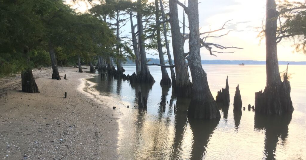
Eastern Shore of Virginia and the Chesapeake Bay Bridge-Tunnel
From Chincoteague in the north to Cape Charles in the south, close to the Chesapeake Bay Bridge-Tunnel. The Virginia portion of the Delmarva Peninsula stretches gently along Route 13. Coastal Virginia awaits. Explore charming beach towns, savor fresh seafood, visit scenic wineries, and meet the famous wild horses of Chincoteague and Assateague.
If you have the time, consider staying the night on Tangier Island for a genuinely Virginian experience. At the beginning or finish of any Eastern Shore road trip, crossing the renowned 17.5-mile Chesapeake Bay Bridge Tunnel is worth the drive.
James River Plantations
Travel Virginia State Route 5, which winds between Richmond and Williamsburg along the scenic banks of the James River. Here, you’ll be greeted by the James River Plantations, a collection of graceful and illustrious estates that stand as testaments to Virginia’s rich history.
These well-preserved James River manor mansions and estates, which have survived three wars, serve as a reminder of the affluent gentleman farmers of Virginia who led affluent lifestyles. Private homes, public hours? Since residences are private, opening times and entry fees vary. Check online for details. Each website has the latest information for your visit.
Luray Caverns
These caves are not only the biggest in Eastern America but also the easiest to get to. The organized, ticketed experience at Luray Caverns functions like a well-oiled machine. Since the excursions are first-come, first-served and depart every 20 minutes, get there early. The Great Stalacpipe Organ, the largest musical instrument in the world, performs an automated concert as part of the introductory tour, which is of the most significant value. Take a moment to consider how many millions of years it took for these caverns to create. Additionally, keep in mind a sweater or jacket since the caverns are always 54 degrees inside.
FAQ
- How Many States Pass Through On The Way From Virginia To California?
Ans: While they take the same length from Virginia to California, each route has its atmosphere. Therefore, the path you choose will depend on your preference for landscape. On the Northern Route, you pass through West Virginia, Kentucky, Indiana, Illinois, Missouri, Kansas, Colorado, Utah, and Nevada.
- Which Route From Virginia To North Carolina Is Most Picturesque?
Ans: The Blue Ridge Parkway, a famed route, links Virginia’s Shenandoah National Park to North Carolina’s Great Smoky Mountains. This breathtaking parkway winds through the southern Appalachians.
- Which State Borders Virginia The Closest?
Ans: Virginia is one of the original 13 colonies and a state that makes up the United States of America. It borders Kentucky to the west, Maryland to the northeast, and the Atlantic Ocean to the southeast, West Virginia to the northwest, and North Carolina and Tennessee to the south. Richmond serves as the state’s capital.
Final Words From Us
Virginia road trip destinations offer everything from stunning mountains and historic sites to charming coastal towns and delicious local flavors. Virginia has a humid subtropical climate that transitions to a humid continental climate west of the Blue Ridge Mountains. Average lows of 25 °F (4 °C) in January and average highs of 86 °F (30 °C) in July are the seasonal extremes. This Place is full of attractions. Choose the right time to visit Virginia to explore the USA.